Keyword Search

- Searches are not case sensitive.
- Use quotes to search for a specific phrase "find me"
- Keyword Search uses OR as the default connector between words.
- Type AND between keywords to find records containing both terms.
- Search for people in two ways: "firstname surname" or "surname, firstname".
- Wildcard searching is done by using an asterisk: cave* will result in cave, caves, cavemen, etc.
- To search for books and periodicals, go to the WKU Libraries One Search Catalog. .
Keyword Search Results
1507 results found sorted by relevance.
-
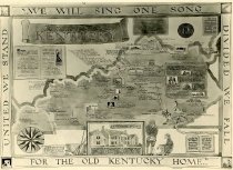
We Will Sing One Song
Black and white photograph showing a map drawn by Ruth Temple showing the Literary associations of Kentucky with areas pinpointed on the map and with the authors who came from the areas.
Record Type: Photo
-
-
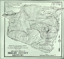
Map of Turkey Knob Gas Field
Glass plate negative of a map of Turkey Knob Gas Field
Record Type: Photo
-
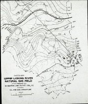
Map of Upper Licking River Natural Gas Field
Glass plate negative of a map of Upper Licking River Natural Gas Field
Record Type: Photo
-
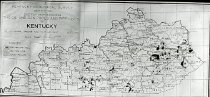
Map of Oil, Gas Pools, and Pipe Lines in Kentucky
Glass plate negative of a map of oil, gas pools, and pipe lines in Kentucky
Record Type: Photo
-
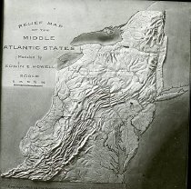
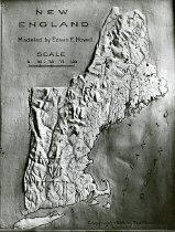
Relief Maps
Glass plate negative of Relief Maps of New England, Middle States, Southern States, Central States, the Western States modeled by Edwin E. Howell, 1899 by the Macmillan Company
Record Type: Photo
-
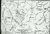
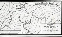
Sketch Map of Clay County, KY Gas Field
Glass plate negative of a sketch map of Oneida gas field, Clay County, KY
Record Type: Photo
-
-
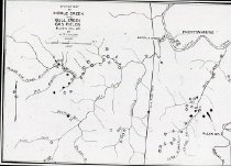
Map of Middle Creek and Bull Creek Gas Fields
Glass plate negative of a map of Middle Creek and Bull Creek Gas Fields
Record Type: Photo
-
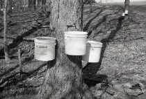
Sugar Maples
Photograph of tapped Sugar Maples on Ellis Mazelin Farm, Allen Co. KY
Record Type: Photo
-
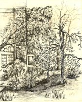
Music Hall - Carpenter, M.
Pen and ink drawing of corner of the Music Building, mapcase 6, drawer 2.
Record Type: Photo
-
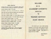
WKU Campus Information - Western Kentucky University
Information sheet for KEA leadership delegates visit to WKU. Includes phone list and campus map.
Record Type: Photo
-
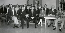
WKU Congress Debating Club - Talisman
Photo includes officers Jam Maples, Jim Owens, Jeanne Jones, Kenneth Williams, John Schneider, Harold Meers, Willson Wood. If you recognize this photo and can help identify the people in it, please send feedback - above.
Record Type: Photo
-
-
-
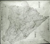
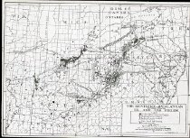
Map of Kentucky-Appalachian Oil and Gas Fields
Glass plate negative of a map of Kentucky-Appalachian oil and gas fields
Record Type: Photo
-
-
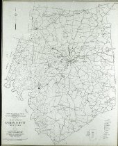
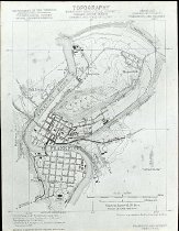
Map of Frankfort, KY and Its Vicinity
Glass plate negative of a map of Frankfort and its vicinity
Record Type: Photo
-
-
Central Atlantic State Relief Map
Glass plate negative of a central Atlantic states relief map
Record Type: Photo